
Itinéraire sélectionné
Via Ferrata de Tière
OuvertK4K4 - difficile
- Durée totale
- 02:30 h
- Accès
- 00:30 h
- Dans la paroi
- 01:00 h
- Retour
- 01:00 h
- Longueur
- 6.4 km
- Montée
- 435 m
- Descente
- 435 m
- Départ
- 1192 m
- Arrivée
- 1192 m
- Point le plus haut
- 1228 m
- Point le plus bas
- 912 m
Liens
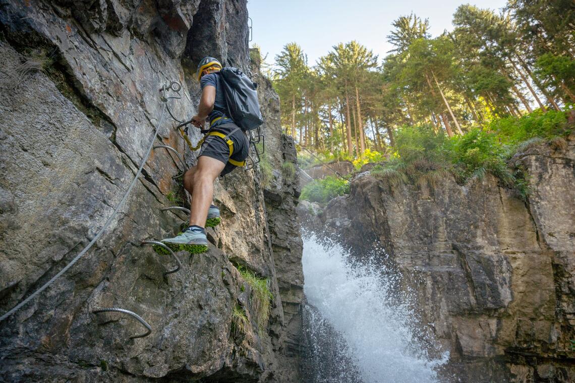
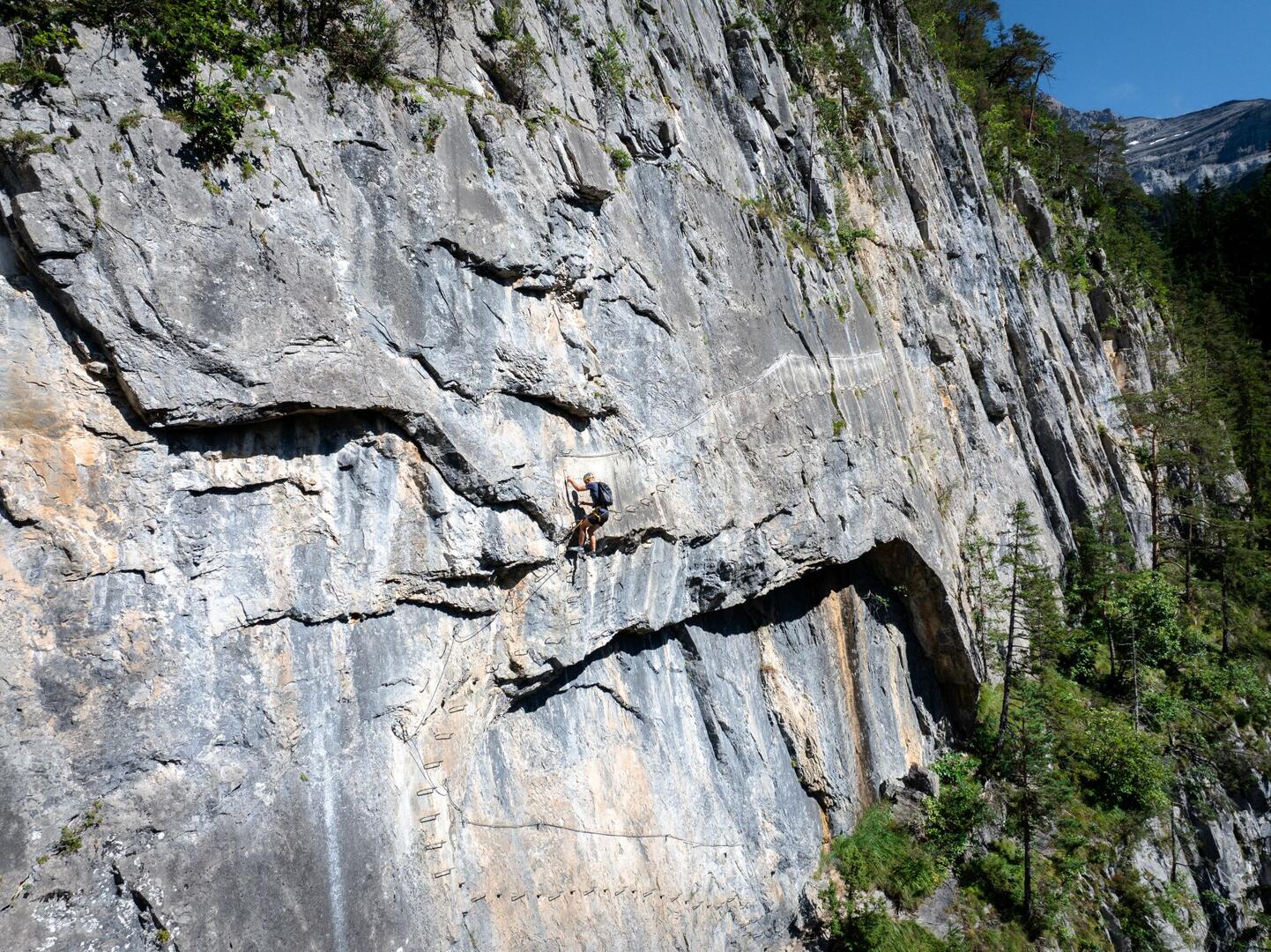
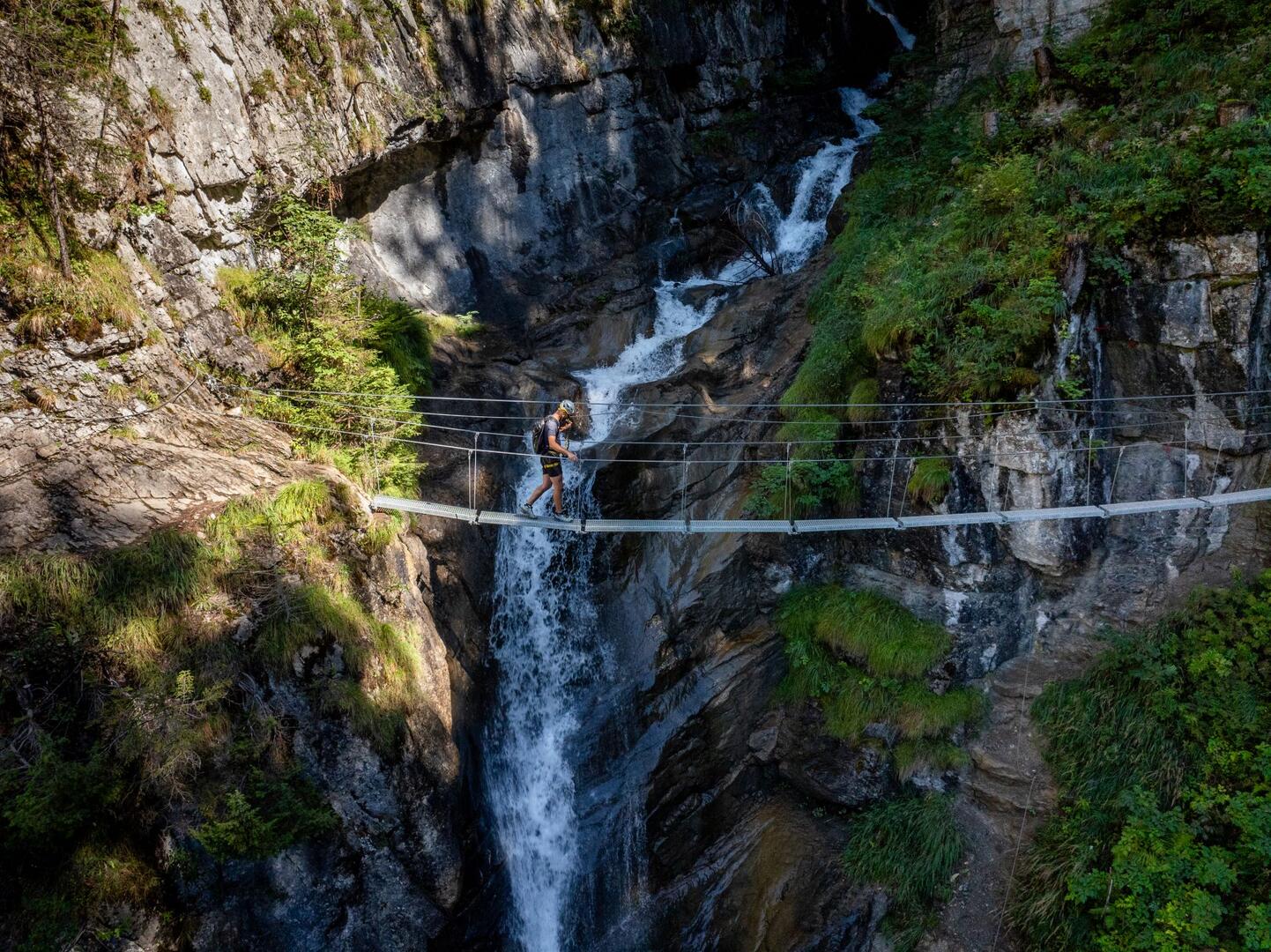
The Via Ferrata de Tière is located in Champéry, Valais, Switzerland. It features a 460-meter route with a 140-meter altitude gain, traversing rock walls with a 75° incline. The route includes two suspension bridges crossing the Tière stream, offering spectacular views of the cascading water below.


