A via ferrata suspension bridge above a green mountain valley.

All Swiss via ferratas

See where the weather is right and head out.

Champéry

Map

Loading map data...

Route details

Selected route

Via Ferrata de Tière

Open
K4K4 - difficult
Total Duration
02:30 h
Getting There
00:30 h
On The Wall
01:00 h
Getting Back
01:00 h
Length
6.4 km
Ascent
435 m
Descent
435 m
Start
1192 m
Finish
1192 m
Highest
1228 m
Lowest
912 m
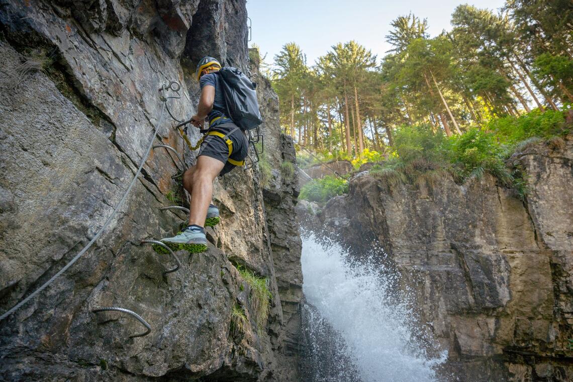
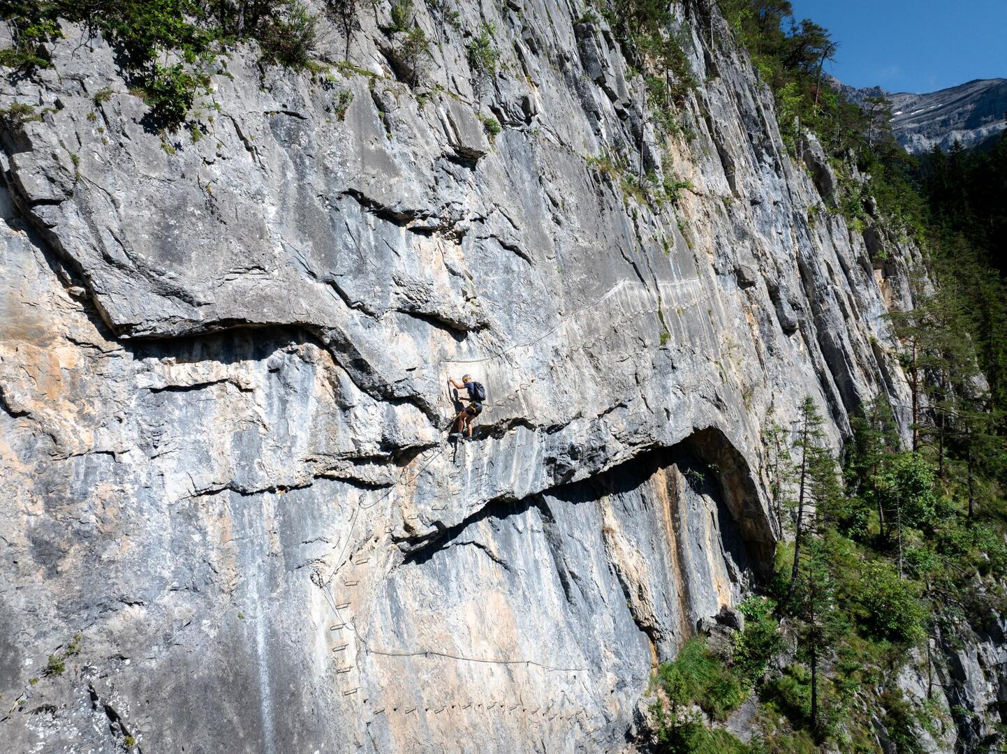
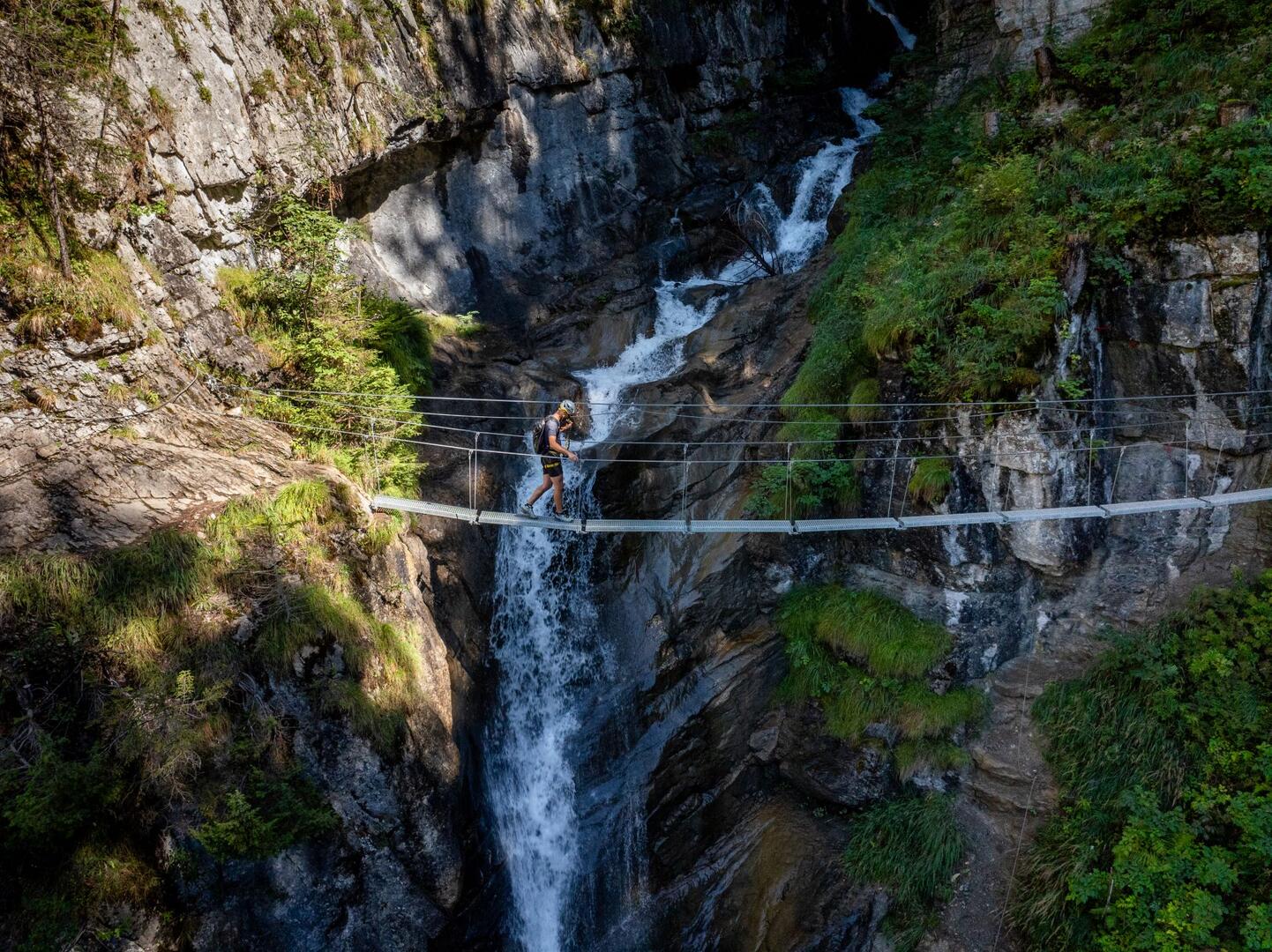
The Via Ferrata de Tière is located in Champéry, Valais, Switzerland. It features a 460-meter route with a 140-meter altitude gain, traversing rock walls with a 75° incline. The route includes two suspension bridges crossing the Tière stream, offering spectacular views of the cascading water below.

Public Transport Stop

  • Champéry-Village

Weather

Day
11:00
13:00
15:00
23.06.
sunny
24.9°C
4.5 km/h
0 mm
sunny
27.2°C
8.2 km/h
0 mm
mostly sunny, some clouds
28.3°C
10.2 km/h
0 mm
24.06.
sunny
24.7°C
4.2 km/h
0 mm
sunny
26.8°C
7.7 km/h
0 mm
mostly sunny, some clouds
27.8°C
7.9 km/h
0 mm
25.06.
sunny
25.1°C
3.8 km/h
0 mm
sunny intervals, chance of thunderstorms
26.8°C
5.8 km/h
0 mm
overcast, slightly stormy
26.8°C
7.6 km/h
0 mm
26.06.
mostly sunny, some clouds
25.3°C
3.2 km/h
0 mm
partly sunny, thick passing clouds
27.2°C
4.7 km/h
0 mm
partly sunny, thick passing clouds
27.9°C
6.7 km/h
0 mm
27.06.
mostly sunny, some clouds
26.9°C
5.7 km/h
0 mm
sunny intervals, chance of thunderstorms
28.6°C
7.4 km/h
0 mm
sunny intervals, chance of thunderstorms
29°C
8.1 km/h
0 mm
28.06.
sunny intervals, chance of thunderstorms
26.2°C
4.7 km/h
0 mm
sunny intervals, chance of thunderstorms
28.7°C
6.7 km/h
0 mm
sunny intervals, chance of thunderstorms
29.7°C
7.8 km/h
0 mm
29.06.
mostly sunny, some clouds
25.2°C
4.7 km/h
0 mm
mostly sunny, some clouds
27°C
7.1 km/h
0 mm
sunny intervals, chance of thunderstorms
27.5°C
8.2 km/h
0 mm
Forecast generated: 22.06.2026 16:23
Source: MeteoSwiss